A 2025 CalFire study revealed that in wildfire-prone areas (such as Elnoka), houses built close together were most likely to burn … “the majority of structure losses in California have occurred in large-loss fires in moderately dense (suburban) communities. In these fires, the structures themselves become fuel and contribute to spread. These existing structures pose a unique challenge in hazard management—they are immobile. While these structures can be hardened, they cannot be readily removed or displaced like many other WUI fuels”—Fire risk to structures in California’s Wildland-Urban Interface
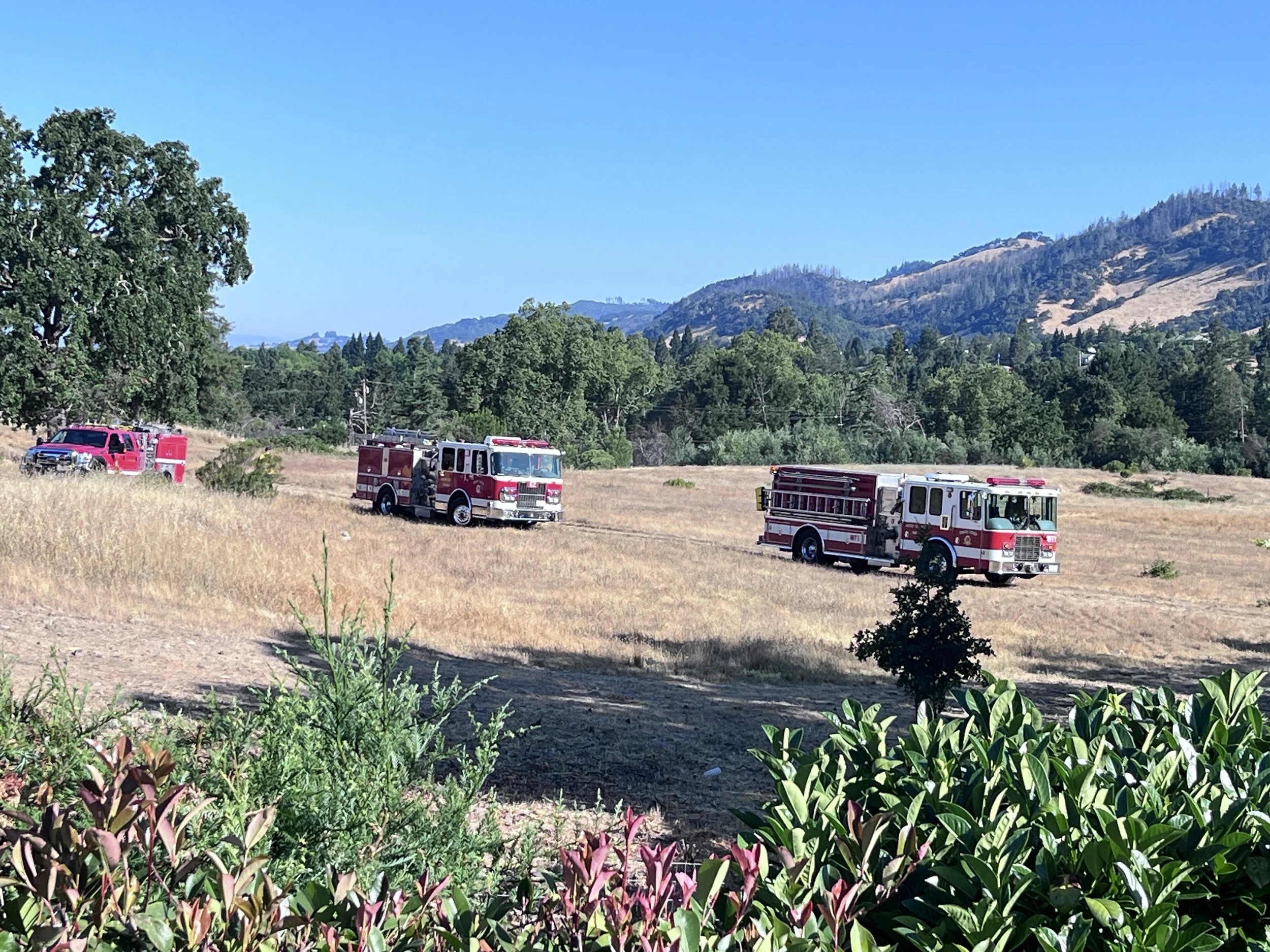
Above: Fire engines in place for a prescribed burn on Elnoka Wildland in 2025. As an open greenspace, Elnoka Wildland provides critical access for fire-fighting equipment, in case a wildfire threatens Oakmont Village.
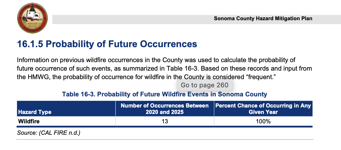
Q: What is the Probability of future wildfire in Sonoma County?
A: 100%
Q: Where should new housing be built?
A: In the city
“Typically, urban infill development occurs on vacant lots, brownfields, or properties that are in decline. By focusing on these areas, cities can rejuvenate neighborhoods, fostering economic growth and social integration. This development strategy also combats urban sprawl, which often leads to environmental degradation and increased transportation costs”—Urban Planning Law
“When houses are built close to forests or other types of natural vegetation, they pose two problems related to wildfires. First, there will be more wildfires due to human ignitions. Second, wildfires that occur will pose a greater risk to lives and homes, they will be hard to fight, and letting natural fires burn becomes impossible” Radeloff, et al.
Q: Where should new housing not be built?
A: In the wildland urban interface (wui)
Q: what is the Wildland urban interface (wui)?
A: Where houses are built in or next to wildlands
“The Wildland-Urban Interface (WUI) fire area is the geographical area where human developments (homes, infrastructure, etc.) meet or intermingle with undeveloped wildland or vegetative fuels, creating a zone of transition where elevated wildfire risk exists”—City of Santa Rosa
Q: Is it safe to build in the wui if Firewise building materials are used?
A: very risky . . . 52% would still burn:
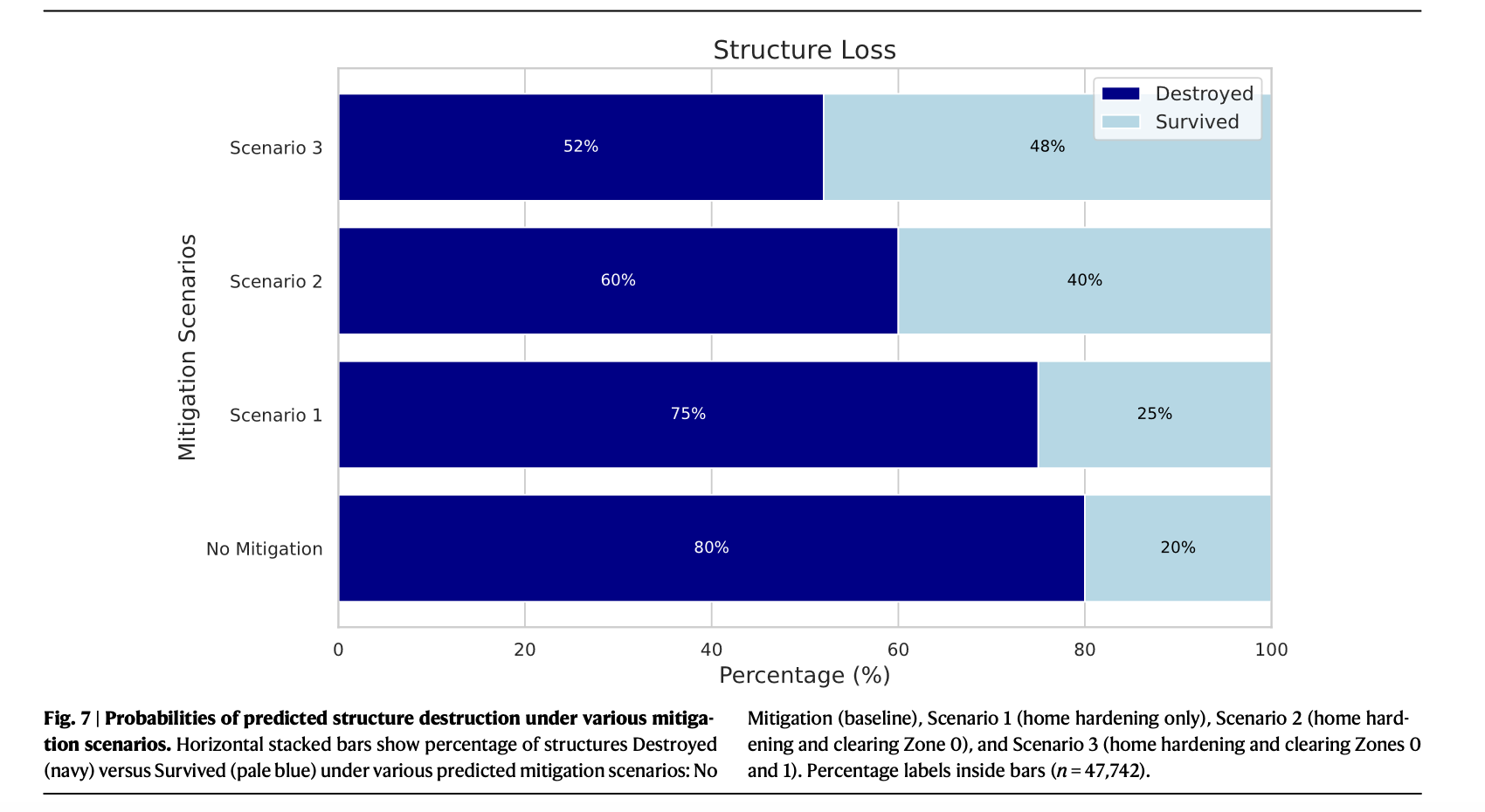
Fire Risk to Structures in California’s Wildland Urban Interface: https://rdcu.be/fcYaW
Houses built with or retrofitted with firewise materials stand a better chance of not burning in a wildfire, but there is still a high probability that they could burn. “A McClatchy analysis following the California Camp Fire in October 2018 found that 51% of the structures--built after WUI California building code requirements took effect—escaped damage as compared to 18% of the 12,100 structures built prior”- American Wood Council, 2025, California — Building Codes & the Wildland-Urban Interface
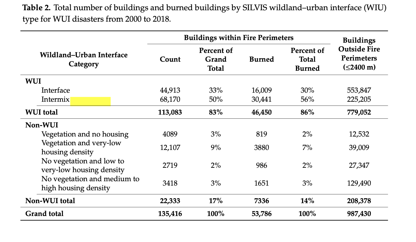
Below is a table showing the number of houses that burned in the Wildland-Urban-Interface (WUI) nationwide, compared to the houses built outside the WUI. “More than half the WUI disasters occurred in California”—from M.D. Caggiano et al.
The wildland urban interface in santa rosa
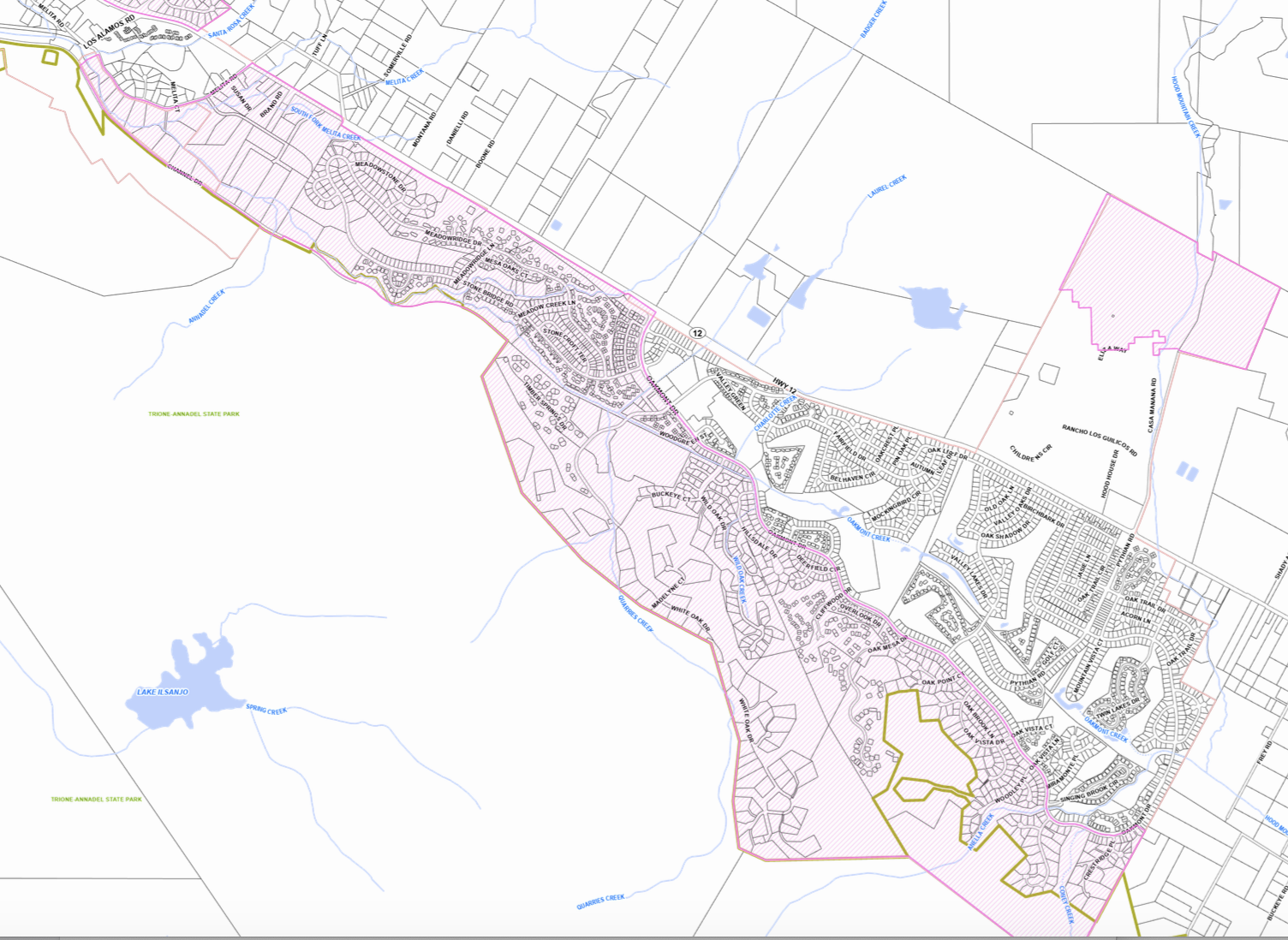
Above: Elnoka wildland & Oakmont Village; pink areas are inside the wildland urban interface.
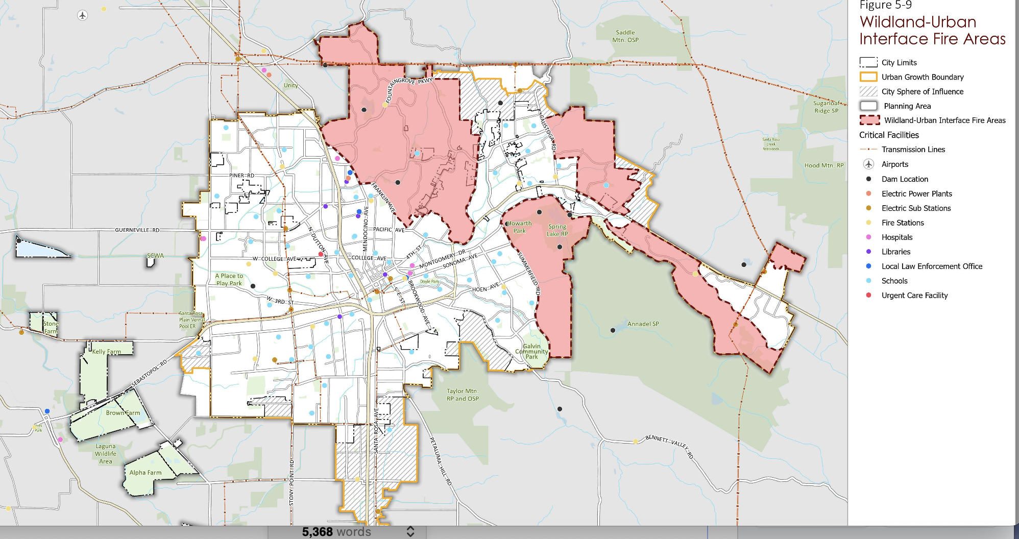
Above: Pink areas are Santa Rosa’s wildland-urban interface (WUI), where buildings are at most risk of burning in a wildfire. Elnoka & Oakmont Village in pink at far right south of Highway 12.
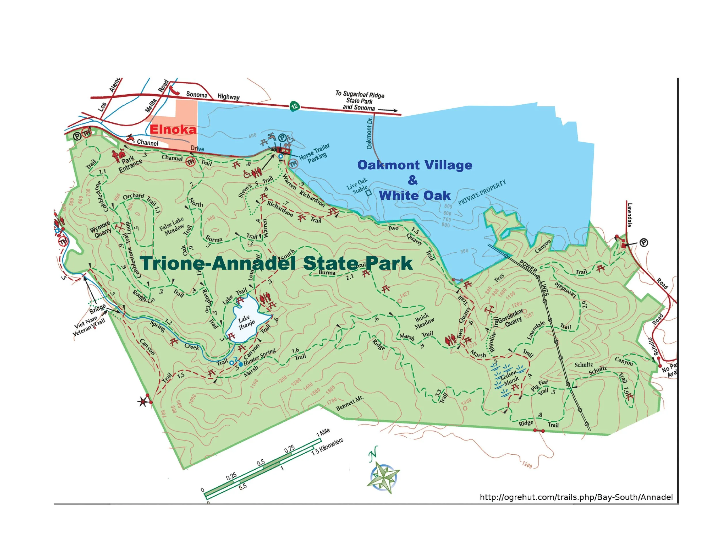
Above: Elnoka wildland in pink, Oakmont Village in blue, Trione-Annadel State Park in green.
“It’s time to address the elephant in the room: the best and possibly only practical way to protect homes from fire is to stop building so many of them in places that are primed to burn” — Kate Anderson
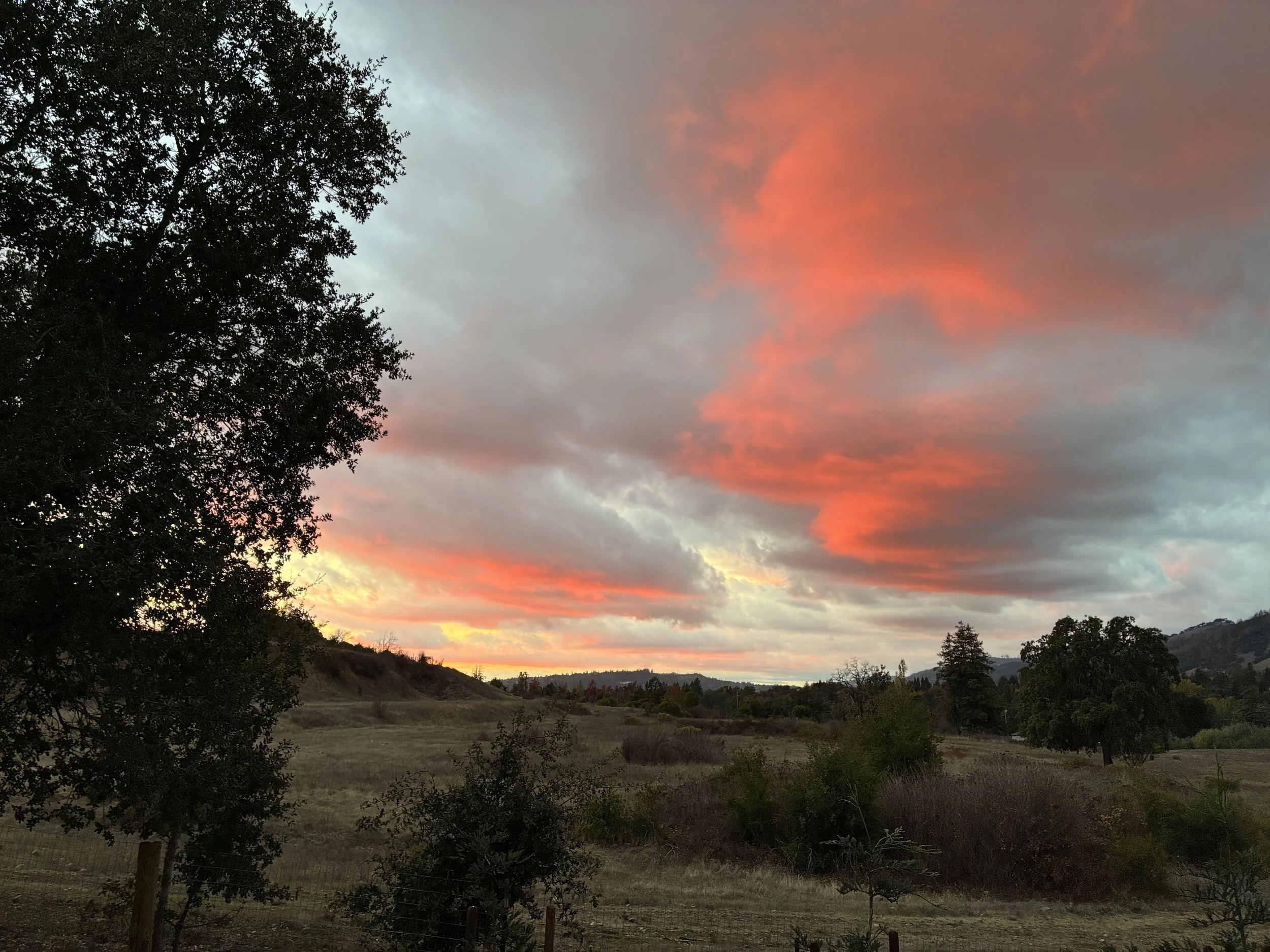
Summer sunset over Elnoka Wildland